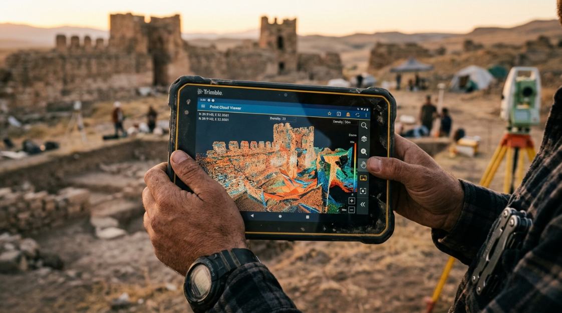

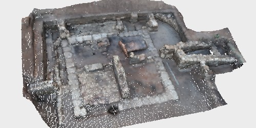
You’ve finished processing in Metashape and your model is ready. Now comes a question that seems simple but is more nuanced than it appears: what format should I export it in? The correct answer depends entirely on where the file is going: a model for 3D printing needs a different format than a model for a video game engine, and both are different from what GIS software requires.
In this guide we cover all the export types that Metashape supports, with specific recommendations for each destination and the key parameters to configure in each case.
The four types of export in Metashape
Before discussing specific formats, it’s important to understand that Metashape generates different types of products, and each one is exported separately with its own menu:
| Product | Route in Metashape | What does it contain? |
|---|---|---|
| 3D Mesh | File → Export → Export model | Polygonal geometry + photorealistic texture |
| Point cloud | File → Export → Export point cloud | XYZ points with RGB color (and classification if any) |
| DEM / DSM / DTM | File → Export → Export Elevation Model | Georeferenced elevation raster |
| Orthomosaic | File → Export → Export orthomosaic | Geometrically corrected, georeferenced aerial photograph |
Each of these products has its own export formats and settings. Let’s look at them one by one.
1. Export the 3D mesh
The mesh is the textured polygonal model: the continuous surface that represents the geometry of the object or scene with its visual appearance.
Path: File → Export → Export model
Available formats and when to use each one
| Format | Extension | When to use it |
|---|---|---|
| OBJ | .obj+ .mtl+ textures | The most universal. Compatible with almost any 3D software: Blender, 3ds Max, Maya, ZBrush, MeshLab, Unity, Unreal. First choice for archiving and general use |
| FBX | .fbx | Preferred for animation pipelines and game engines (Unity, Unreal Engine). Supports textures, armatures, and multiple objects in a single file. |
| STL | .stl | Exclusively for 3D printing. Contains only geometry, no texture or color. Required by most slicers (Cura, PrusaSlicer, Chitubox). |
| DAE (Collada) | .dae | 3D exchange format. Compatible with Google Earth, SketchUp, Blender, and many web viewers. |
| PLY | .ply | Used in research and scientific software. Supports vertex attributes (color, normals). Compatible with MeshLab and CloudCompare. |
| 3DS | .3ds | Autodesk legacy format. Only use if the target software specifically requires it. |
| GLB / glTF | .glb | Ideal for web visualization and augmented reality. Very efficient in terms of size. Compatible with browsers, Sketchfab, Microsoft Teams, and Cesium. |
| U3D | .u3d | For 3D models embedded in interactive PDFs |
.pdf | Direct export of interactive 3D model to PDF, without additional software | |
| DXF | .dxf | For CAD software (AutoCAD, Civil 3D). Geometry only, no textures. |
Key parameters when exporting the mesh
Coordinate system: If the model is georeferenced, you can choose between exporting it in the project’s reference system (real-world coordinates) or in local coordinates centered on the model. For 3D visualization or printing, local coordinates are more practical. For GIS or topographic CAD, use the georeferenced system.
Save texture: You’ll almost always want to enable this option. Without texture, the model is exported in uniform gray.
Texture format: JPEG for models where file size matters (web, distribution), PNG for maximum quality without loss (archive, cultural heritage).
Texture size: The exported size depends on the texture size you set when creating it. If you need to reduce the file size, you can export the texture at a lower resolution.
Tip: For OBJ files, the exported file is always a set of three files:
.obj(geometry),.mtl(material), and one or more texture image files. Always keep them in the same folder, or the model won’t display the texture correctly in other software.
📷 Image Idea (IA): Visual diagram showing a textured 3D model of a historic building with arrows pointing to icons of different destinations (Blender, Unity, 3D printer, web browser), technical infographic style on a dark background.
2. Export the point cloud
The point cloud contains the millions of three-dimensional points with XYZ coordinates and RGB color generated during processing.
Path: File → Export → Export point cloud
Available formats
| Format | Extension | When to use it |
|---|---|---|
| THE | .las | Industry standard for geospatial data. Compatible with ArcGIS, QGIS, AutoCAD Civil 3D, Global Mapper, and CloudCompare. Supports point classification. |
| LAZ | .laz | Compressed version of LAS. Same content, up to 10x less disk space. Ideal for archiving and transferring. |
| PLY | .ply | For 3D and scientific software. Supports spot color. |
| E57 | .e57 | Standard for laser scanner data. Compatible with BIM and surveying software (Leica Cyclone, Autodesk ReCap) |
| PTS | .pts | For terrestrial scanning software (Leica Cyclone) |
| XYZ / TXT | .txt | Simple text format. Compatible with almost everything, useful for importing coordinates into spreadsheets or custom scripts. |
| PCD | .pcd | Point Cloud Library (PCL) format, used in robotics and computer vision |
| Potree | .zip | For web visualization of massive point clouds with the Potree viewer |
| Cesium 3D Tiles | .zip | For visualization on web geospatial platforms (Cesium, ArcGIS Online) |
Important options when exporting the point cloud
Save colors (RGB): Enable this option whenever the target software supports them. A colored cloud is much more informative than a grayscale cloud.
Save point classes: If you classified the point cloud (terrain, vegetation, buildings), activate this option to preserve that information in the exported LAS/LAZ file.
Save trust: exports the trust value of each point as an additional attribute, useful for later filters in CloudCompare or GIS software.
Coordinate system: essential for topographic projects. Verify that it matches the reference system expected by the target software.
Note: OBJ and DXF formats do not support color information in the point cloud. If you need to preserve RGB colors, use LAS, LAZ, PLY, or E57.
📷 Image Idea (AI): Dense point cloud of a bridge or industrial structure with RGB color gradient, with the icon of the different file formats floating around (LAS, LAZ, PLY, E57), black background, technical style.
3. Export the elevation model (DEM / DSM / DTM)
An elevation model is a raster that represents the height of each point on the terrain or surface. It is the primary product for surveying, hydrological, and mapping applications.
Path: File → Export → Export Elevation Model
Available formats
| Format | Extension | When to use it |
|---|---|---|
| GeoTIFF | .tif | Industry standard. Compatible with ArcGIS, QGIS, Global Mapper, AutoCAD Civil 3D, and GRASS GIS. First choice in almost every case. |
| BIL | .bil | ESRI raster format, compatible with ArcGIS |
| XYZ | .txt | X, Y, Z coordinates as text, for import into spreadsheets or scripts |
| SRTM HGT | .hgt | For compatibility with SRTM global elevation data |
Key settings
Resolution: defines the pixel size of the exported DEM, expressed in the unit of the coordinate system (meters if using UTM, degrees if using geographic). A resolution of 5 cm/px is very detailed for low-altitude flights; for higher-altitude flights, 10–30 cm/px is more typical.
Coordinate system: critical. Choose the correct system for your region. In Argentina: WGS84 / POSGAR 07, with the Gauss-Krüger projection corresponding to the zone’s area.
Vertical elevation data: You can apply geoid correction (geoid undulation) if you need the heights to be orthometric (referenced to mean sea level) instead of ellipsoidal. This is essential for surveying and infrastructure projects.
📷 Image Idea (IA): DEM of a terrain with elevation color scale (blue for low areas, red for peaks), with superimposed contour lines, GIS technical map style.
4. Export the orthomosaic
An orthomosaic is a georeferenced orthophoto: a geometrically corrected aerial image, ready for use in GIS as a map layer.
Path: File → Export → Export orthomosaic
Available formats
| Format | Extension | When to use it |
|---|---|---|
| GeoTIFF | .tif | GIS standard. Preserves embedded georeferencing. Compatible with ArcGIS, QGIS, Global Mapper, and Google Earth Pro. |
| JPEG | .jpg | For distribution or visual use where size matters. Loses georeferencing. |
| KMZ / KML | .kmz | For direct viewing in Google Earth |
| MBTiles | .mbtiles | For tile-based web maps and mobile field applications |
| World + Image | .tfw+ image | Image with separate georeferencing file, for software that does not read embedded GeoTIFF |
Key settings
Compression: For GeoTIFF, you can choose between no compression (maximum quality, large file size), LZW (lossless, good size reduction), or JPEG (lossy, smaller file size). For working files and client deliverables, LZW is the ideal balance.
Export in blocks: For orthomosaics of large areas exceeding 4 GB, Metashape allows exporting in blocks ( tiles ) for compatibility with software that does not handle very large raster files.
Resolution: By default, Metashape exports at the maximum calculated resolution. You can reduce it if the destination is web display or if the resulting file is too large.
📷 Image Idea (IA): Top-down orthophoto of an urban or agricultural area with superimposed coordinate grid and visible graphic scale, professional GIS style.
Quick guide: format according to final destination
| Destination | Product for export | Recommended format |
|---|---|---|
| Blender / Maya / 3ds Max | 3D Mesh | OBJ (with PNG texture) |
| Unity / Unreal Engine | 3D Mesh | FBX |
| 3D printing | 3D Mesh | STL |
| Substance 3D Painter | 3D Mesh | FBX |
| SketchUp | 3D Mesh | DAE (Collada) |
| ArcGIS / QGIS | Point cloud | LAS / LAZ |
| ArcGIS / QGIS | Elevation | GeoTIFF |
| ArcGIS / QGIS | Orthophoto | GeoTIFF |
| AutoCAD Civil 3D | Point cloud | THE |
| AutoCAD Civil 3D | Elevation | GeoTIFF |
| Google Earth | 3D Mesh | DAE / KMZ |
| Google Earth | Orthophoto | KMZ |
| Leica Cyclone / BIM | Point cloud | E57 |
| Sketchfab / web | 3D Mesh | GLB / OBJ |
| Massive web display | Point cloud | Potree / Cesium 3D Tiles |
| Archive / Heritage | 3D Mesh | OBJ + PLY |
| Archive / Heritage | Point cloud | E57 / LAS |
Advanced tip: reduce the model before exporting
If the model has too many polygons for the intended use (for example, for web or real-time display), you can decimate it before exporting without needing to reprocess:
Tools → Mesh → Mesh Decimating
Choose the polygon reduction percentage according to the destination:
- Web/real-time display: 90–95% reduction (retaining 5–10% of the original polygons)
- Client presentation: 50–70% reduction
- Archive / high fidelity: undecimated
Tip: Duplicate the chunk before decimating if you want to preserve the original high-resolution model: right-click on the chunk → Duplicate chunk.
Conclusion
Metashape is one of the photogrammetry software programs with the broadest export compatibility on the market. The key is understanding what type of product the recipient needs—mesh, point cloud, DEM, or orthomosaic—and choosing the correct format for that specific software. With the table in this guide, that decision takes only seconds.
At Aufiero Informática , official distributors of Agisoft Metashape in Argentina, we help you choose the right license and resolve technical questions about the workflow.
👉 View Agisoft Metashape licenses at Aufiero Informática
Frequently Asked Questions
Should you use OBJ or FBX to import your model into Blender? Both work well in Blender. OBJ is simpler and more universal; FBX is preferable if your model has multiple objects or complex materials. For photogrammetric models without animation, OBJ is usually sufficient.
Which point cloud format is best for QGIS? LAS or LAZ? QGIS has native support for both. LAZ is preferable due to its smaller file size without data loss.
Can I export the orthomosaic as a JPG instead of a GeoTIFF? Yes, but JPG loses the georeferencing information. For GIS use, always use GeoTIFF. JPG is only useful for visual distribution or presentations where file size is more important than accuracy.
Does Metashape export directly to BIM formats? Not directly, but you can export the mesh in FBX or IFC-compatible format (via intermediate tools) and the point cloud in E57, which is the standard format for importing survey data into BIM software such as Autodesk Revit or Archicad.
Does the STL model exported for 3D printing include the texture? No. STL only contains the geometry (the triangle mesh). The texture cannot be printed with most standard 3D printers. If you have a multi-color printer and want to include color, use the OBJ or PLY format with per-vertex color attributes.
Can I export only part of the model? Yes. Use the selection tools to select the region of interest in the mesh or point cloud, then choose Export Selection when exporting.