


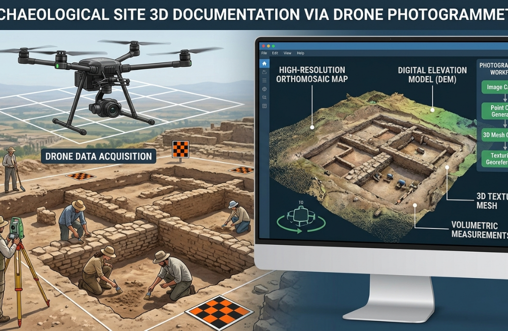
Measuring a site on foot has always been slow. For a surveyor or field team, a full day in the field might cover a few hundred square meters with acceptable accuracy. Scaling that to hectares means days of work, multiple field trips, and a data consolidation process that takes as long as the survey itself.
And that’s before talking about errors. In manual surveying, every measurement is an opportunity to introduce inaccuracies that accumulate across the project. The data reaches the office, the problem surfaces, and the team has to go back to the field. On projects with tight deadlines and budgets, that isn’t just an inconvenience — it’s a real risk.
For surveying, civil engineering, cultural heritage management, and environmental monitoring teams, the manual method has a ceiling. And that ceiling is reached sooner than it seems.

What Changes When the Drone Carries the Camera
Drone photogrammetry isn’t a new technology, but its accessibility is. Today, a professional team can fly over a multi-hectare site in minutes, capture hundreds of images with controlled overlap, and have a dataset that previously required days of fieldwork.
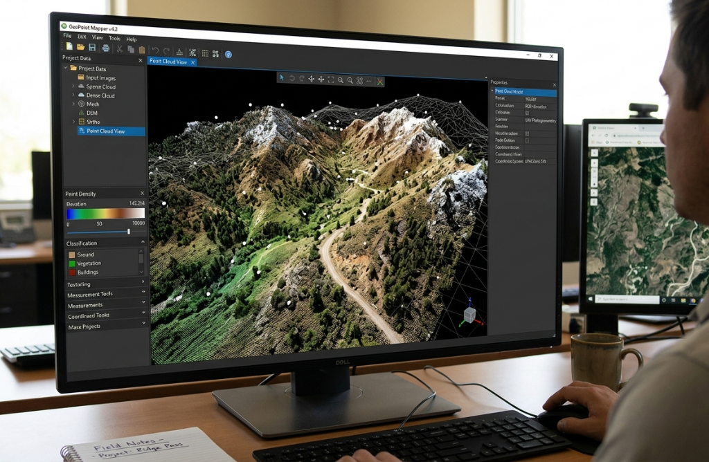
The next step is turning those images into useful information: maps, elevation models, point clouds, orthophotos. And that’s where the software comes in.
Drone surveying combined with Agisoft Metashape produces accurate 3D maps, digital elevation models, orthophotos, and point clouds from overlapping aerial images. The result: high-precision models for decision-making, planning, inspection, and measurement.
What Metashape Is and Why It’s the Industry Standard
Agisoft Metashape is a standalone software product that performs photogrammetric processing of digital images and generates 3D spatial data for use in GIS applications, cultural heritage documentation, visual effects production, and indirect measurements of objects at various scales.
In practice, Metashape takes photos from a drone — or any camera — and converts them into three-dimensional models with survey-grade precision. It delivers topographic accuracy when ground control points, RTK/PPK geotags, or camera calibration are used. It accepts RGB, multispectral, thermal, fisheye, and even scanned images, and automates projects through Python scripting or batch processing.
It’s not just a 3D modeling tool. It’s a geospatial processing platform that produces deliverables directly usable in engineering, GIS, and asset management workflows.
Surveying: From Days in the Field to Hours of Processing
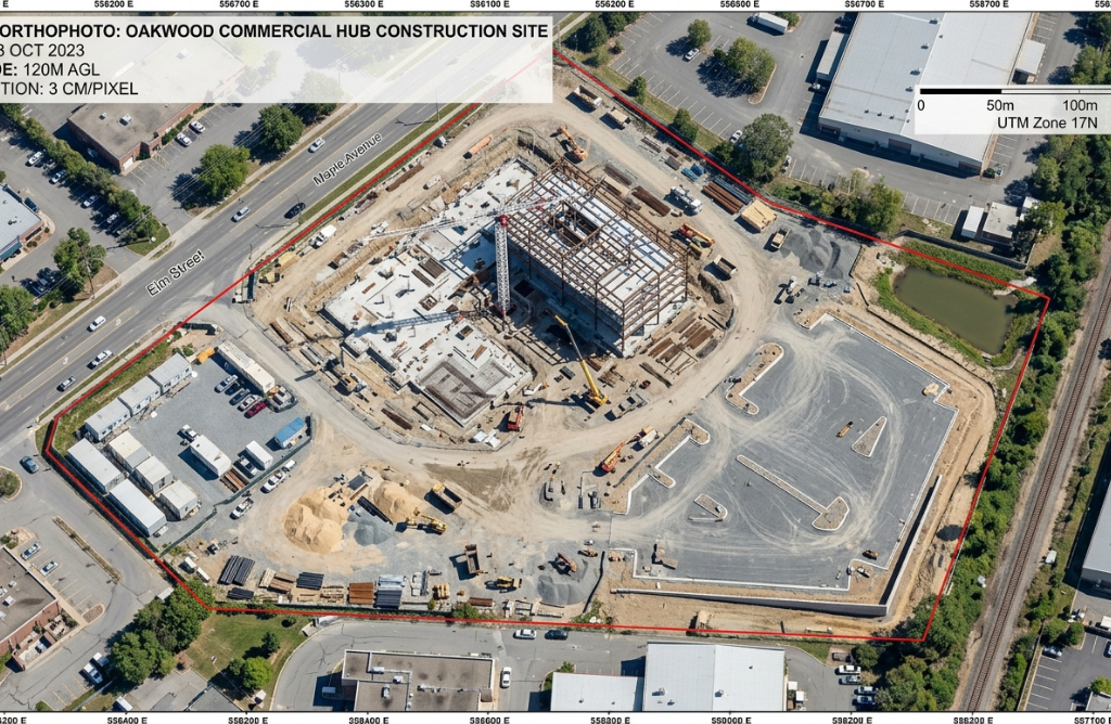
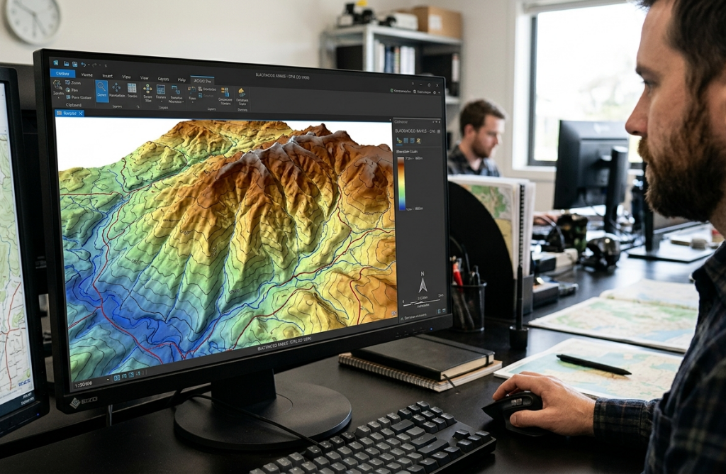
For surveying teams, the most significant change Metashape introduces isn’t model quality — it’s time. Surveyors use drones to capture overlapping aerial photos that Metashape converts into accurate elevation models, used for flood risk analysis, construction planning, and erosion studies.
A survey that previously required several days of fieldwork can be reduced to a minutes-long flight plus office processing. The data is more complete, more consistent, and easier to update when the terrain changes. And human error in data capture drops dramatically because flight conditions are controllable and repeatable.
For civil works, mining, watershed management, or urban planning projects, that’s a concrete difference in cost and timeline.
Cultural Heritage: Documenting What Can’t Be Lost
Metashape’s application in cultural heritage is especially relevant because the nature of what’s being documented leaves no room for error or second chances.
Archaeologists use Metashape to create 3D reconstructions of ancient ruins, artifacts, and excavations. These models are invaluable for documentation, restoration planning, and virtual conservation. Metashape’s ability to process oblique and close-range images is ideal for fragile sites.
An archaeological site under intervention, a historic building in the process of deterioration, a sculpture requiring restoration: in all these cases, the 3D model generated by photogrammetry is both a record of what exists and the working basis for what comes next.
The same applies to facade documentation, restoration intervention records, or generating digital twins of heritage buildings that require long-term management.
Infrastructure and Monitoring: Risk-Free Inspection, Precise Data
Beyond surveying and heritage, Metashape has a growing presence in infrastructure inspection. It supports RGB and thermal images, integrates with RTK/PPK drone data, and allows GCP-based georeferencing — essential for engineering models. It captures high-resolution 3D models of infrastructure for analysis and measurement.
Bridges, industrial structures, power lines, dams: inspecting these assets using traditional methods involves risk to people and access limitations. With a drone and Metashape, the team captures data from the air and produces a 3D model that enables measurement, analysis, and comparison with previous versions — without requiring physical access to hazardous areas.
AI-Powered Features for More Efficient Workflows
Metashape has introduced several intelligent AI-driven features that streamline everything from point cloud classification to depth map generation. AI adds the ability to detect, classify, and interpret features without human intervention, leading to faster workflows with less manual editing.
For teams processing large image volumes — extensive flights, multiple sites, data from different seasons — those improvements translate directly into less processing time and more consistent results across projects.
Where Aufiero Informática Comes In
Metashape is distributed in LATAM by Aufiero Informática, an authorized distributor with experience in technical and professional software for surveying, engineering, and heritage teams.
If your team still relies on manual measurements to survey land, document sites, or inspect infrastructure, now is the time to evaluate the change. Talk to an Aufiero specialist:
Frequently Asked Questions About Metashape
What is Agisoft Metashape and what is it used for?
Metashape is a professional photogrammetry software that converts digital images into accurate 3D models, maps, orthophotos, and point clouds. It is used in surveying, archaeology, civil engineering, infrastructure inspection, precision agriculture, and cultural heritage documentation.
What types of images does Metashape process?
Metashape processes standard RGB, multispectral, thermal, and fisheye images captured by drones, DSLR cameras, or smartphones. It supports RTK/PPK data and allows georeferencing through ground control points for survey-grade accuracy.
What outputs does Metashape generate from images?
Metashape generates textured 3D models, dense point clouds, digital elevation models, high-resolution orthophotos, and GIS data exportable in multiple formats compatible with engineering and cartography software.
Does Metashape work with DJI drones?
Yes. Metashape is compatible with DJI’s main enterprise drone models, including those equipped with RTK/PPK capabilities for greater geospatial precision.
Where can I purchase Metashape in LATAM?
Through Aufiero Informática, official Metashape distributor in the region. You can request a consultation with a specialist through the link available on this page.