


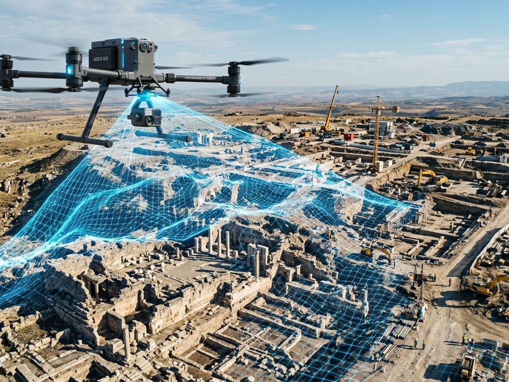
Drone photogrammetry has transformed surveying. What once required weeks of work with total stations, leveling equipment, and field crews can now be done in hours: a drone flies autonomously over the area, captures hundreds of precisely overlapping photos, and software like Agisoft Metashape converts those images into orthomosaics, digital elevation models, and point clouds with centimeter-level accuracy.
In this article we explain the complete process, from flight planning to final deliverables, with a focus on how to make the most of Metashape Professional’s capabilities in topographic workflows.
Why use drone photogrammetry for surveying?
Traditional surveying with a total station remains unsurpassed for millimeter-precise stakeout and the measurement of specific points. But for area surveys—land mapping, construction monitoring, volumetric calculations, and general planimetry—photogrammetry with drones offers advantages that are hard to ignore:
| Criterion | Classical topography | Photogrammetry with drones |
|---|---|---|
| Capture speed | Slow (days for large areas) | Very fast (hours for hundreds of hectares) |
| Coverage | Point by point | Full area coverage |
| Visual documentation | Coordinates and dimensions only | Orthophoto + 3D model + point cloud |
| Access to dangerous areas | Limited | Drones access without personal risk |
| Planimetric accuracy | ±1–5 mm | ±1–3 cm (RTK + GCPs) |
| Altimetry accuracy | ±1–5 mm | ±2–5 cm (RTK + GCPs) |
| Cost for large areas | High | Low |
| GIS/CAD Integration | Requires additional processing | Direct (GeoTIFF, LAS, DXF) |
Drone photogrammetry does not replace traditional surveying; it complements it. For stakeout, critical elevation measurements on construction sites, or points requiring millimeter precision, the total station remains the appropriate tool.
📷 Image Idea (AI): Isometric view of a DJI drone flying over a construction site, with nadir flight lines drawn in yellow and a grid of GCPs visible on the ground, photorealistic technical render style.
The necessary equipment
The drone
For professional surveying, the choice of drone largely determines the workflow and achievable accuracy. The most commonly used models in the sector are:
Drones with integrated RTK (recommended for surveying)
- DJI Phantom 4 RTK
- DJI Mavic 3 Enterprise RTK / Matrice 350 RTK
- Autel EVO Max 4T RTK
RTK drones record precise coordinates of the projection center of each photograph at the time of shooting, significantly improving the external orientation of images in Metashape and reducing reliance on GCPs.
Drones without RTK (require more GCPs)
- DJI Mavic 3 Classic / Air 3
- DJI Mini 4 Pro (for small and non-critical projects)
With drones lacking RTK, the embedded GPS has an accuracy of ±1–3 meters. This is sufficient for initial orientation, but requires a dense network of GCPs to achieve centimeter-level accuracy.
Flight planning software
Before flying, the area must be planned using autonomous mission software:
- DJI Pilot 2 (for DJI RTK drones)
- DroneDeploy / Pix4Dcapture (cross-platform)
- Mission Planner (open source, for drones with ArduPilot autopilot)
Agisoft Metashape Professional
For drone surveying, the Professional edition of Metashape is essential. Key features that differentiate it from the Standard edition in this context include: GCP import, georeferencing with flight logs, DEM/DTM generation, contour lines, GIS export, and point cloud classification.
📷 Image idea (AI): DJI Phantom 4 RTK drone over an open field during a mission flight, blue sky with few clouds, photorealistic professional photography style.
Phase 1: Flight Planning
Good planning is the difference between a successful lift and one that has to be repeated.
Define the target GSD
The GSD ( Ground Sample Distance ) is the size that each pixel represents on the ground. It determines the level of detail of the orthomosaic and the possible accuracy of the survey.
The basic formula for calculating GSD is:
GSD (cm/px) = (Altura de vuelo (m) × Tamaño de píxel del sensor (µm)) / Longitud focal (mm) × 100As a practical reference:
| Flight altitude | Approximate GSD* | Recommended use |
|---|---|---|
| 30 m | ~0.8–1.2 cm/px | Maximum detail, heritage, archaeology |
| 60 m | ~1.5–2.5 cm/px | High-precision surveying, civil works |
| 80–100 m | ~2–3 cm/px | Standard topographic survey |
| 120 m | ~3–4 cm/px | General cartography, agriculture |
| 150–200 m | ~4–6 cm/px | Large areas, low precision |
*Exact values depend on the drone’s sensor and optics.
For civil works surveying, the range of 60–100 m in height with a GSD of 2–3 cm/px is the optimal balance between detail and efficiency.
Configure the overlap
Overlap ensures that each point on the terrain appears in enough images for a robust reconstruction:
- Frontal overlap: 80–85% for flat terrain; 85–90% for complex terrain or terrain with structures
- Lateral overlap: 70–75% for flat terrain; 75–80% for complex terrain
A smaller overlap can create gaps in the point cloud and errors in the DEM. A larger overlap increases the number of photos and processing time, but improves the robustness of the model.
Add oblique shots
For terrain with vertical structures (buildings, slopes, retaining walls), purely nadir shots leave the vertical faces uncovered. Adding a complementary mission with the camera tilted 30–45° significantly improves the reconstruction of these areas.
📷 Image Idea (IA): Top-view technical diagram of a nadir flight grid with parallel flight lines and arrows indicating frontal and lateral overlap, on a background of terrain seen from above, cartographic style.
Phase 2: Ground Control Points (GCPs)
Ground control points (GCPs) are the bridge between the photogrammetric model and the real-world coordinate system. They are physical points on the ground whose coordinates (X, Y, Z) are measured with high-precision GPS before or after the flight.
How many GCPs do I need?
| Drone technology | Recommended minimum GCPs | Checkpoints |
|---|---|---|
| Without RTK | 5–8 well distributed | 3–5 additional |
| With RTK | 2–3 strategic | 3–5 required |
| With PPK | 2–3 strategic | 3–5 required |
Checkpoints are measured ground points (GCPs) that are NOT used in Metashape georeferencing. They are used only to validate the accuracy of the final model. They are as important as control GCPs: without checkpoints, you cannot certify the actual accuracy of the survey.
Distribution of GCPs
Distribution matters more than quantity. One GCP in the center of the area and the rest in the corners, well distributed around the perimeter, yields better results than many GCPs grouped together.
- Place GCPs in the corners of the area and in the center
- Avoid GCPs in areas with obstacles that hinder visibility from the air
- Physical targets (printed crosses, contrasting colored discs) must be clearly visible in the photos — at least 5×5 pixels in the image
RTK vs PPK vs GCPs: When to use each one?
Classic GPS + dense network of GCPs: higher possible accuracy, more fieldwork. Recommended when accuracy is critical and the area is small to medium-sized.
RTK drone + GCP verification: reduces fieldwork while maintaining high accuracy. Real-time correction lets you know if the positioning was correct before leaving the site.
PPK drone + verification GCPs: similar to RTK in final accuracy, more robust against GNSS signal interruptions. Ideal in areas with intermittent signal. Post-processing of the coordinates is done in the office.
📷 Image Idea (IA): Target GCP on the ground (paper printed cross or colored disc on the ground), with the drone visible in the background performing the flight, realistic photographic style.
Phase 3: Processing in Agisoft Metashape Professional
With the photos downloaded and the GCP coordinates obtained, the processing in Metashape follows this flow:
1. Import photos and check quality
Create a new project, import all the photos, and check the image quality ( Tools → Estimate Image Quality ). Discard any photos with a quality score lower than 0.7.
2. Align photos
Workflow → Align photos
Recommended parameters for topography:
- Accuracy: High
- Reference preselection: Enabled (if photos have GPS coordinates in EXIF metadata)
- Key point limit: 40,000–60,000
3. Import and mark the GCPs
File → Import → Import waypoints
Import the CSV file containing your GCP coordinates (format: name, X, Y, Z or latitude, longitude, height). Verify that the coordinate system in the file matches the one configured in the Metashape Reference panel.
Then, for each GCP:
- I opened the photos where it’s visible using the Bookmarks panel
- Double-click on the photo to open it in high resolution
- Drag the marker to the exact center of the target
Each GCP must be marked on at least 3 photos , ideally 5 or more.
4. Update the transformation and optimize
With all GCPs selected, click Update Transform in the Reference panel. Then run:
Tools → Optimize Cameras
Check the GCP errors in the Reference panel:
- XY error < 3–5 cm for standard projects
- Z error < 5–8 cm for standard projects
- The checkpoints (marked but not used in the transformation) should show similar errors
If any GCP has a much higher error than the rest, check if it was correctly marked in the photos or if the coordinates have a typo.
5. Build the dense point cloud
Workflow → Build dense point cloud
- Quality: High (for standard surveying) / Ultra High (for detailed inspection)
- Filtering: Moderate
6. Classify terrain points
Tools → Dense Point Cloud → Classify Ground Points
This classification is essential for generating a DTM that represents only bare soil, excluding vegetation and structures. Adjust the maximum angle and cell size according to the complexity of the terrain.
7. Generate DEM and orthomosaic
Workflow → Build Elevation Model
- Source: Dense point cloud
- Type: DTM (using only points classified as terrain) or DSM (entire surface)
Workflow → Build orthomosaic
- Resolution: according to the GSD of the flight
8. Generate contour lines (optional)
Tools → Generate contour lines
Metashape generates contour lines directly from the DEM. Configure the interval according to the scale of the delivery plan (1 m for general mapping, 0.5 m or 0.25 m for detailed topography).
📷 Image Idea (AI): Stylized capture of the Metashape Reference panel showing GCPs with centimeter errors and validated checkpoints, dark professional technical style interface.
Phase 4: Final Deliverables
A drone topographic survey processed in Metashape can generate the following products, all georeferenced:
| Deliverable | Format | Target software |
|---|---|---|
| Orthomosaic | GeoTIFF | ArcGIS, QGIS, AutoCAD, Google Earth |
| DTM / DSM | GeoTIFF | ArcGIS, QGIS, Civil 3D, Global Mapper |
| Point cloud | LAS / LAZ | ArcGIS, QGIS, Civil 3D, CloudCompare |
| Contour lines | DXF / SHP | AutoCAD, Civil 3D, QGIS |
| Processing report | Project documentation |
The Metashape processing report
Metashape automatically generates a PDF report of the processing that includes:
- Flight and processing parameters
- GCP and checkpoint errors (in meters)
- Coverage map and image overlap
- Camera calibration parameters
- Point cloud and DEM statistics
This report is the quality certification document for the survey and is essential to deliver along with the products to the client or for internal documentation.
Tools → Generate report
📷 Image Idea (IA): Top-down orthomosaic of a construction site or field with coordinate grid and superimposed graphic scale, with the GCPs marked as colored points on the image, professional GIS style.
Typical achievable accuracies
With a well-executed workflow, drone photogrammetry and Metashape Professional make it possible to achieve:
| Configuration | Horizontal accuracy | Vertical accuracy |
|---|---|---|
| Drone without RTK + dense GCP network | ±2–3 cm | ±3–5 cm |
| RTK Drone + Verification GCPs | ±1.5–3 cm | ±2–4 cm |
| PPK drone + verification GCPs | ±1.5–3 cm | ±2–4 cm |
Vertical accuracy is always less than horizontal accuracy in photogrammetry. If the project requires high-precision altimetry (±1 cm), consider supplementing it with precision leveling points or LiDAR.
When NOT to use photogrammetry with drones
Drone photogrammetry has important limitations that need to be known:
Dense vegetation: Under a closed forest, the rays do not reach the actual ground. The DTM will represent the vegetation canopy, not the terrain. In these cases, LiDAR is the only reliable alternative.
Textureless surfaces— large expanses of water, uniform fine sand, or fresh snow—make photogrammetric reconstruction difficult or impossible. The matching algorithm cannot find commonalities between images.
Critical altimetric accuracy (< 1 cm): for works that require millimeter altimetry (leveling of slabs, verification of slopes in channels), the total station remains irreplaceable.
Adverse weather conditions: strong wind, rain, fog or very intense sunlight affect image quality and flight stability.
Conclusion
The combination of drones with RTK or PPK and Agisoft Metashape Professional represents the most efficient standard for area surveying today. In the hands of an experienced operator, it allows for centimeter-level accuracy in a fraction of the time and cost required by traditional surveying for the same areas.
The result is not just a set of coordinates: it is a georeferenced orthophoto, a digital terrain model, a classified point cloud, and a certified quality report, all integrated and ready to import into the client’s GIS or CAD software.
At Aufiero Informática , official distributors of Agisoft Metashape in Argentina, we can advise you on the Professional license and assist you in implementing this workflow in your operation.
👉 See Agisoft Metashape Professional at Aufiero Informática
Frequently Asked Questions
Do I need a license to fly drones in Argentina? Yes. The ANAC (National Civil Aviation Administration) regulates the use of drones in Argentina. For commercial operations, the operator must be a licensed RPA Pilot and the drone must be registered. Consult the current regulations on the official ANAC website.
Is a DJI Mini 4 Pro suitable for professional surveying? For small, non-critical projects, it might work. But its limitations (no RTK, no interchangeable high-resolution camera, and short battery life) make it unsuitable for professional precision surveying. For serious commercial work, a DJI Mavic 3 Enterprise RTK or Phantom 4 RTK is the minimum recommended entry-level option.
How much ground can a drone cover in one flight? It depends on the drone, the flight altitude, and the overlap. For reference, a DJI Phantom 4 RTK at 100 m altitude with 80/70% overlap can cover 30–40 hectares per flight (approximately 20–25 minutes of usable battery life).
Which is better for surveying: RTK or PPK? Both offer similar accuracy in the final result. RTK allows you to verify the positioning quality in the field before departure. PPK is more robust against signal loss during flight and does not require a field base (it can be used with data from CORS stations). The choice depends on the operational context.
Is Metashape Standard suitable for surveying? No, not for georeferenced surveying. Importing and using GCPs, generating DEMs/DTMs, and exporting in GIS formats are features exclusive to Metashape Professional.