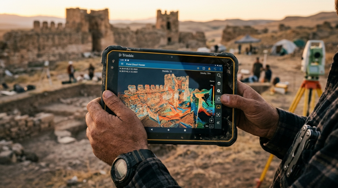

Going back to the field because the survey didn’t reach the required accuracy means lost time and money. The problem is almost never the drone: it’s the workflow. Here is how to fix it.
Any surveying, agriculture or engineering team that works with drones knows the scene: the flight went well, the images look sharp and the model seems right. Yet when it’s time to validate, the differences against the points measured on the ground exceed the project tolerance, and the only way out is to return to the site. This article explains why it happens and how a controlled workflow built on Agisoft Metashape lets you close accuracy before leaving the field.
The problem: surveys that don’t close
You fly, you process, and when you validate the result it doesn’t reach the accuracy the project demands. You have to go back to the field, re-fly and re-process, with cost, weather and deadlines working against you.
In surveying, agriculture or engineering, that rework is not a detail: it is the problem that keeps photogrammetry from ‘closing’ for demanding requirements.
The real cost of rework is rarely measured in full. On top of flight and travel hours, you have to add crew rescheduling, weather and light windows that don’t always repeat, delays in delivery to the client and, on projects with contractual deadlines, the risk of penalties. Every extra trip to the field erodes the project margin and the trust of whoever is waiting for the result.
Why it happens: lack of control and workflow
Accuracy is not achieved just by flying better. It comes from well-measured ground control points (GCPs), controlled processing and a quality validation that confirms the result is reliable.
When that control is missing, the result ‘looks good’ but does not withstand a measurement or an audit, and that is when the return trip to the field appears. In practice, the causes repeat from one project to the next:
- Insufficient or poorly distributed ground control points, concentrated in one part of the area and absent at the edges.
- GCP coordinates measured without a consistent method or without checking the reference system.
- Relying only on the drone’s own positioning, with no RTK or PPK and no control points to back it up.
- Processing with default parameters, without reviewing alignment quality or filtering unreliable points.
- Not separating control points from check points, so the reported error is optimistic.
- Discovering problems in the office, when the crew has already left the site.
None of these causes depends on the drone brand. They are all workflow decisions, which is why an orderly process can fix them.
The solution: a controlled workflow in Metashape
Metashape is built for accuracy: it lets you integrate GCPs, control the processing and filter quality, producing georeferenced and certifiable orthomosaics and digital elevation models (DEM).
With measured GCPs and a controlled workflow, accuracy is planned and verified before leaving the field, not discovered late in the office.
Want to see how this workflow applies to your projects? Talk to an Aufiero specialist and define a field plan that closes accuracy on the first try.
Step by step: from flight to certifiable deliverable
A field workflow that closes on the first try relies on concrete steps:
- Plan the flight and the GCP layout according to the required accuracy.
- Measure the GCPs well and integrate them into the processing.
- Validate quality (residual errors) before packing up in the field.
- Export georeferenced orthomosaic and DEM, ready for GIS.
1. Plan the flight and the GCP layout
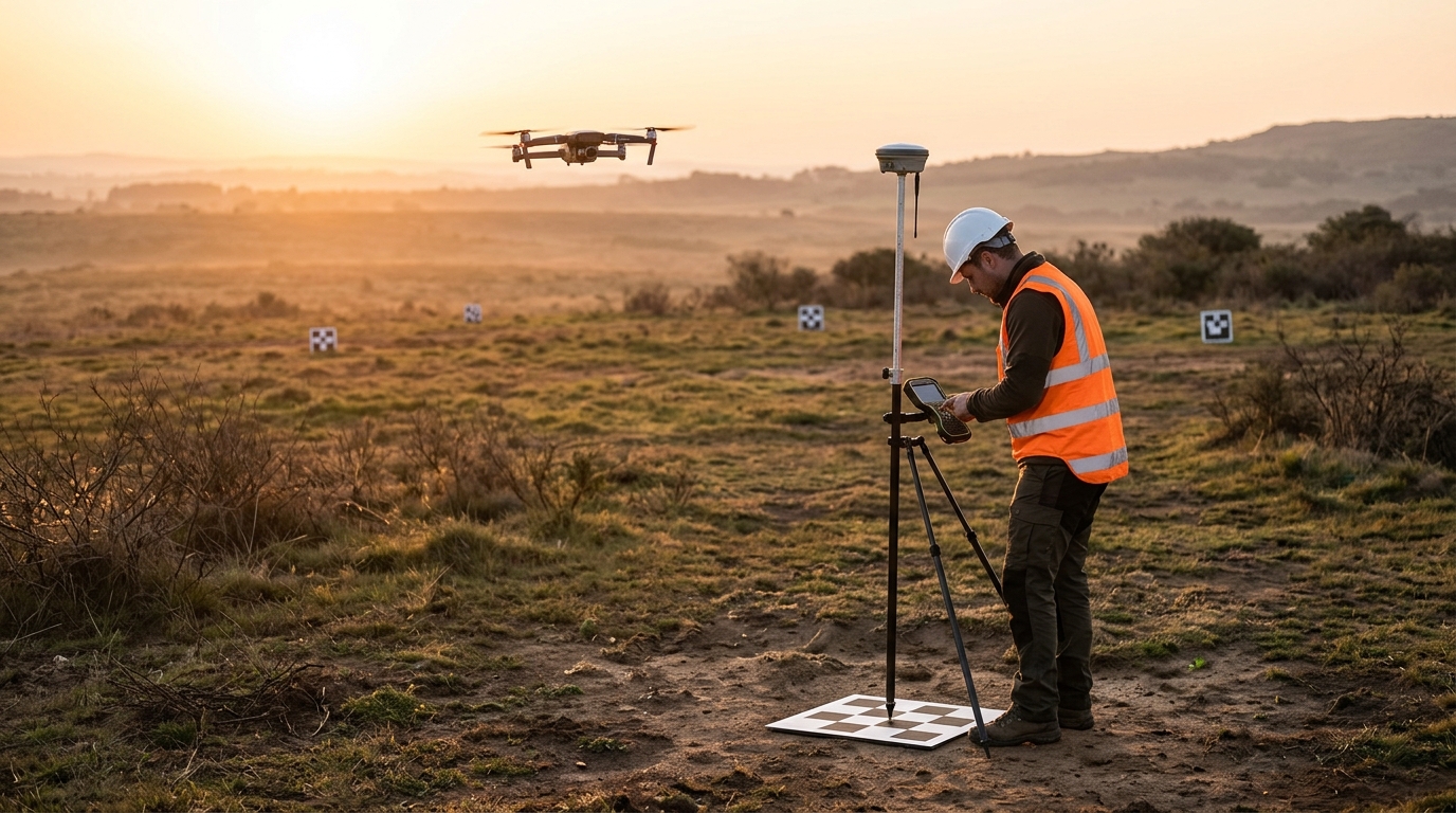
The required accuracy defines the plan. With a tight tolerance, image overlap, flight height and ground sample distance (GSD) must be chosen to sustain it, and the GCPs must cover the whole perimeter of the area as well as the interior, including changes in elevation. An even distribution matters more than a high number of points concentrated in a single sector.
2. Measure the GCPs well and integrate them into the processing
GCPs are measured with a method more precise than the accuracy required of the final product, and in the project’s coordinate system. In Metashape, their coordinates are imported, the points are located in the images where they are visible, and camera alignment is optimized with that information. Reserving some of the points as check points lets you measure the error with data the adjustment did not use.
3. Validate quality before packing up
With the model aligned and adjusted, Metashape reports the residual errors of each point and the total error. If a point drifts from the tolerance, you can still review its marker, measure another point or fly an additional area, without having left the site. That check in the field is what avoids the return trip.
4. Export georeferenced orthomosaic and DEM, ready for GIS
Once the adjustment is validated, the point cloud, the digital elevation model and the orthomosaic are generated and exported in standard formats such as GeoTIFF, in the project’s coordinate system. That way the deliverables open directly in GIS and CAD platforms, with no intermediate conversions that could introduce shifts.
GCPs and check points: adjusting is not the same as validating
A control point (GCP) takes part in the adjustment: the software uses it to correct camera positions and the scale of the model. A check point, on the other hand, does not take part: it is compared against the already adjusted model to measure how far off it is. If every measured point is used as control, the residual error will be low by construction, but that does not prove the rest of the area is equally accurate.
Separating the two types of points is a simple practice that turns the accuracy report into defensible evidence in front of a client or an audit. Metashape lets you mark each point as control or check and review their errors separately, so the team knows, before leaving, whether the result meets the requirement.
It is also worth recording the date, measurement method, equipment and reference system used for each point. That documentation is part of the deliverable and makes it easier to repeat the work with the same parameters if the project is updated later.
What to review before leaving the field
Before packing the equipment, it pays to run a quick but systematic check on the processing. These are the points that give the most information:
- Total error of the GCPs and of the check points, compared against the project tolerance.
- Individual errors per point, to detect incorrect markers or poorly measured points.
- Camera alignment quality and the number of tie points at the edges of the area.
- Areas with gaps, dense vegetation or reflective surfaces where the model may lose reliability.
- Consistency of the coordinate system and heights (ellipsoidal or orthometric) with what the client requires.
If everything is in order, the processing report generated by Metashape stays as backup for the work. If something doesn’t close, it is corrected on the spot, with the crew still on site and field conditions still valid.
Where this matters most
Surveying and cadastre: certifiable accuracy is the deliverable. The client, the regulator or the professional who signs the plan needs to know how accurately each element was measured, and a per-point error report answers that question.
Agriculture: orthomosaics and multispectral support guide management decisions, such as field zoning, detecting stressed areas or tracking the crop between seasons. To compare different dates, consistent georeferencing is essential.
Engineering and civil works: the georeferenced DEM feeds the design, volume calculation and progress tracking. An elevation error that looks small on the plan can translate into cubic meters of difference in an earthmoving job.
In every case, the value is not just the image: it is reliable data that doesn’t force you to go back.
Benefits of a workflow that closes on the first try
Moving from a reactive workflow to a controlled one has measurable effects on the operation:
- Fewer return trips to the field and fewer re-flights.
- More predictable delivery times.
- Reproducible results, with documented parameters.
- Accuracy reports that back up the delivery to the client.
- Greater team confidence in the data before delivering it.
Each of these frees up hours for the technical team, which can go to new projects instead of repeating one that was thought to be closed.
Conclusion
Going back to the field because the survey doesn’t close the accuracy is a workflow problem, not a matter of luck. With GCPs, controlled processing and quality validation, Metashape delivers georeferenced and certifiable orthomosaics and DEMs, so accuracy gets resolved in the field, not on the return trip.
At Aufiero Informática we help you implement Metashape and its field workflow (official license, training and local support) so that every survey closes on the first try.
If you are evaluating photogrammetry software, you may also be interested in our comparison of Agisoft Metashape and RealityCapture.
Frequently asked questions: accuracy in the field workflow with Metashape
Why doesn’t my survey reach the required accuracy?
Almost always because of a lack of control: without well-measured GCPs, controlled processing and quality validation, the result does not withstand a certifiable measurement.
What are GCPs and why do they matter?
They are precisely measured ground control points; integrated into the processing, they are the basis for a georeferenced and reliable result.
Does Metashape produce GIS deliverables?
Yes: it exports georeferenced orthomosaics and DEMs, and supports multispectral imagery for agriculture and analysis.
Does this avoid going back to the field?
By validating quality before leaving the site, the need to re-fly and re-process is drastically reduced.
Do I need RTK or PPK if I use GCPs?
They are not mutually exclusive. RTK or PPK positioning improves the initial accuracy of the cameras and reduces dependence on GCPs, but control points remain the most direct way to verify the final result against the ground.
How many GCPs do I need for a project?
It depends on the size of the area, the terrain and the required accuracy. What matters is not only the number, but that they are well distributed and that some are reserved as check points. A specialist can help you define the right number for each project.
Book a Metashape demo with Aufiero and build a field workflow that closes accuracy on the first try.